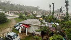
Super Typhoon Bavi is screaming across the western Pacific right now, and it's carrying the kind of power that makes even the most seasoned islanders pack up and head for concrete shelter. Packing sustained winds of 165 mph—putting it firmly at Category 5 strength—the monster storm is tracking straight toward Guam and the Commonwealth of the Northern Mariana Islands. The National Weather Service in Tiyan didn't sugarcoat the situation, calling Bavi a significant and dangerous threat. If you're on the island, the time to sit back and watch the radar has officially run out.
The core issue isn't just the wind speed. It's how fast this storm blew up and the sheer volume of water it's dragging along. Island residents started moving into emergency shelters on Sunday as the outer bands began to show their teeth. The storm is moving west at a slow crawl of about 8 to 10 mph. In the world of typhoons, a slow-moving system is bad news. It means the destructive eyewall lingers longer over whatever piece of land it hits, grinding away at infrastructure instead of passing quickly. Forecasters expect the center to pass near Rota before slicing between Guam and Saipan early Monday, meaning everyone in the archipelago will catch a piece of the beating.
The Category 5 Monster Racing Toward the Marianas
Tropical storms thrive on warm water, and the Pacific is practically boiling this season. Bavi went through a massive burst of rapid intensification, jumping from a basic typhoon to a full-blown Category 5 beast in less than a day. Meteorologists at the Joint Typhoon Warning Center watched the storm's central pressure plummet as its eye cleared out, signaling an incredibly efficient, tight engine of destruction.
When a storm hits these speeds, the traditional categories almost lose their meaning. We're talking about wind gusts projected up to 190 mph near the center. The National Weather Service issued a blunt warning for Guam, Rota, Tinian, and Saipan. The local government placed Guam in Condition of Readiness 2, prompting immediate closures and emergency mobilizations.
The steering currents around Japan are pushing Bavi on a path that keeps it over exceptionally high sea-surface temperatures. Even if the storm undergoes an eyewall replacement cycle—a natural process where a giant storm swaps its inner core for an outer ring—it has so much atmospheric support that it's unlikely to weaken significantly before making its closest approach. You can expect the worst of the weather to slam the islands from Sunday evening through Monday afternoon.
What Happens When a 165 MPH Storm Hits
Let's look at what these numbers actually mean on the ground because a lot of people see wind speeds on a screen and don't grasp the physical reality. At 165 mph, air behaves less like a breeze and more like a solid wall.
Wind and Structural Failure
The Joint Information Center laid out exactly what to expect for different types of housing. If you're living in a poorly constructed home with a sheet-metal roof, the structure will likely fail. The wind gets under the edges of the metal, creates massive upward lift, and rips the panels away like paper. Even well-constructed frame homes can face partial wall failures and blown-out windows. This is why emergency managers are telling anyone not living in a reinforced concrete structure to get out immediately. Loose outdoor objects turn into deadly missiles. A plastic patio chair or a stray piece of lumber traveling at 100 mph will punch straight through standard walls.
The Threat of Coastal Inundation
The wind gets the headlines, but the ocean does the real killing. A Coastal Flood Watch is active, and the ocean conditions are downright terrifying. The NWS projects massive breaking waves between 25 and 35 feet along east-facing reefs. To put that in perspective, that is the height of a three-story building crashing down on the shoreline.
The storm surge near the eye could reach 15 feet. When that volume of water hits the shallow reefs, it has nowhere to go but inland. Low-lying coastal roads will become impassable by Sunday night. Beachside businesses and critical infrastructure will take direct hits, leading to severe shoreline erosion that could permanently reshape parts of the coast.
Flash Floods and Mudslides
Bavi is carrying an immense amount of moisture. Satellite data suggests the storm could dump between 12 and 20 inches of rain across the Marianas as it passes. When that much rain falls on an island over a short period, the ground saturates instantly. Rivers and streams will burst their banks, and water will collect in low-lying areas with nowhere to drain. If you live near a steep hillside, the risk of mudslides is incredibly high. The water liquefies the topsoil, causing entire hillsides to give way without warning.
The Ghost of Typhoon Sinlaku
The anxiety across Guam and Saipan right now is palpable, mostly because residents are still recovering from Super Typhoon Sinlaku, which battered the region back in mid-April. Sinlaku left a trail of broken power poles, shredded roofs, and flipped cars. Tens of thousands of people lost electricity for weeks, and the local economy took a massive hit.
The most tragic reminder of Sinlaku's power was the loss of the cargo ship MV Mariana. The vessel suffered catastrophic engine failure right as the storm peaked, causing it to capsize. Rescue crews recovered the body of one crew member, while five others disappeared into the ocean and are presumed dead. That disaster proved that even large commercial vessels are completely helpless when the Pacific turns violent.
Having two super typhoons threaten the same small island chain within a span of just a few months is rare and exhausting. People haven't finished repairing the damage from April, and now they have to board up the same windows again. The emotional toll on the community is just as significant as the physical damage.
FEMA, Plywood, and the Reality of Island Survival
Living on an isolated island means you can't just drive out of the storm's path. You either ride it out in a sturdy building or you rely on the supplies already on the island. Local hardware and lumber stores saw massive lines starting early Saturday morning as residents rushed to buy plywood, generators, and flashlights.
For small business owners, the timing is brutal. Local merchants explained that they spent hundreds of dollars on lumber just to protect their shops, wiping out the fragile profits they made while trying to bounce back from the previous storm. When a typhoon forces a shutdown, businesses lose days of revenue while their fixed costs like rent and utilities keep piling up.
On the institutional side, the Federal Emergency Management Agency has already positioned teams on Guam. FEMA's local distribution center is stocked with resources to handle the immediate aftermath:
- 1.1 million liters of fresh water
- 1.2 million ready-to-eat meals
- 6,700 cots for emergency shelters
- 90 large-scale generators to keep critical facilities running
The U.S. Coast Guard has also been working around the clock. Crews secured their bases on Guam, hauled small response boats out of the water onto trailers, and ordered their large cutters to get underway. It sounds counterintuitive to send ships out into a storm, but large cutters are much safer riding out heavy seas in the open ocean than they are banging against a concrete pier inside a harbor. The downside is that on-water rescue capabilities will be non-existent during the height of the storm. If someone gets into trouble at sea on Sunday night, no one is coming to get them until the eye passes.
How Residents Are Preparing for the Worst
The attitude on the ground is a mix of high stress and practical resilience. People who live in solid concrete homes generally feel safe from structural collapse, but they still dread the sound of the wind. A 160 mph wind howling through the eaves sounds like a continuous freight train roaring through your living room. It causes the air pressure inside the house to fluctuate, making ears pop and keeping everyone awake for hours.
For tourists, the situation is pure panic. Flights out of Guam's international airport were systematically canceled as the weather deteriorated on Sunday, leaving visitors stranded in their hotels. While hotels are generally built out of reinforced concrete and possess heavy-duty backup generators, staying in a strange place during a Category 5 typhoon is a nerve-wracking experience.
The government opened five public schools as emergency evacuation centers, offering space for roughly 1,900 vulnerable residents. These shelters are designed for individuals who live in wooden structures, tin shacks, or low-lying flood zones. Local mayors have been working directly with their communities to ensure elderly and disabled residents have transport to get to these shelters before the roads flood.
The Safe Steps to Take Right Now
The window to prepare is shutting fast. If you are reading this from the Marianas, you need to execute your emergency plan immediately. Don't wait for the first gusts to start breaking branches.
First, secure your water supply. When the power grid goes down, water treatment plants often stop running. Clean your bathtubs and fill them with water for flushing toilets and washing. Store separate, clean containers for drinking water—aim for at least one gallon per person per day for a minimum of three days.
Second, if you own a portable generator, check where it's positioned. A shocking number of typhoon-related injuries and deaths happen after the storm passes because people run generators inside their garages, porches, or tool sheds. Carbon monoxide is an invisible, odorless killer. The generator must sit outside, at least 20 feet away from any door, window, or ventilation intake.
Third, take care of your documents and communications. Pack your passports, birth certificates, and insurance policies into waterproof bags. Charge every power bank, phone, and tablet you own right now. Set your phone to low-power mode and stop wasting battery scrolling through social media videos once the storm starts. You need that battery life to monitor emergency broadcasts or call for help if things go south.
Lastly, stay out of the ocean. It doesn't matter how strong of a swimmer you think you are. The rip currents and massive shore breaks generated by Bavi are lethal. Keep away from the beaches, stay inside your designated shelter, and wait until official emergency management channels give the clear signal that the danger has passed. Bavi is a historic storm, and surviving it requires total respect for the power of the weather.
(mh=0tsfgPKBvEq_de4S)0.jpg)