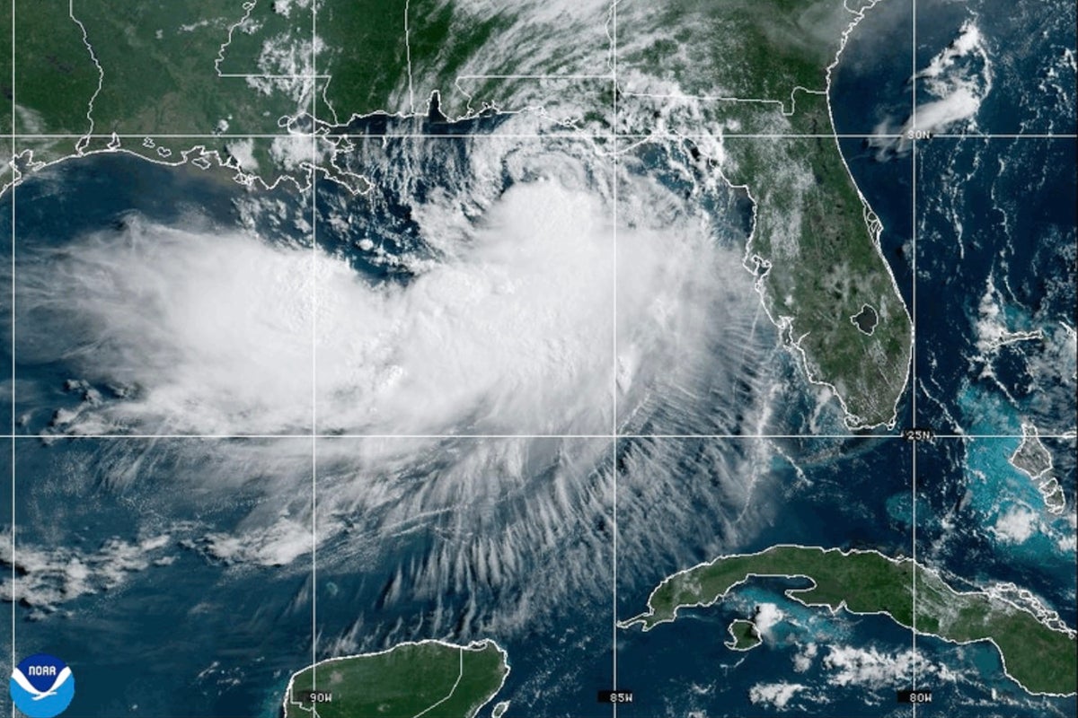
When a named tropical system creeps toward the Gulf Coast, most headlines zero in on a single metric: where and when the eye makes landfall.
That is a dangerous mistake with a system like Tropical Storm Bertha.
As Bertha pushes slowly across the northern Gulf of Mexico toward southeast Louisiana, officials from the Florida Panhandle to Morgan City have hoisted double-red flags, shuttered public beaches, and opened sandbag distribution hubs. Yet many residents and tourists look at the modest 50-to-60 mph sustained winds and assume it's business as usual.
Fixating on the exact point of landfall misses how asymmetrical storms work. As National Hurricane Center meteorologists point out, landfall is almost irrelevant here. The core hazard isn't a tight wall of hurricane-force wind, but a broad, sprawling field of weather that extends roughly 100 miles from the center, dragging dangerous surf, 4-foot storm surges, and relentless rain across hundreds of miles of shoreline.
Here is what's really happening along the Gulf Coast right now, why slow-moving storms carry hidden traps, and what you actually need to do if you're in Bertha's path.
Why Landfall Location Matters Far Less Than You Think
In popular weather reporting, "landfall" gets treated like the main event. In reality, landfall simply means the physical center of the storm's circulation crosses the coastline.
With Tropical Storm Bertha, tropical-storm-force winds stretch 100 miles outward from that center. That means severe conditions hit Pensacola, Mobile, and Gulfport hours—or even days—before the center ever touches down near coastal Louisiana.
When a storm moves at a sluggish 5 to 6 mph, it hovers over the same coastal zones for a grueling stretches of time. That prolonged duration drives three major threats:
- Coastal Inundation: Persistent onshore winds continually push ocean water into bays, sounds, and estuaries. Bertha is generating storm surges up to 4 feet from the mouth of the Mississippi River over to the Alabama border.
- Saturated Ground and Flash Floods: Rainfall predictions range from 2 to 4 inches, with isolated pockets seeing much higher totals. Areas in coastal Mississippi are already dealing with ground saturated by earlier summer rainfall from Tropical Storm Arthur, making even modest downpours an immediate flash flood risk.
- Rip Currents and Invisible Waves: Long before rain hits, energy transfer creates deadly rip currents. Beaches might look sunny, but the undertow will pull experienced swimmers out to sea in seconds.
"Landfall really doesn't have a whole lot of meaning in this particular case." — Robbie Berg, Warning Coordination Meteorologist, National Hurricane Center
What Local Preparation Actually Looks Like On the Ground
While tourists in places like Perdido Key or Pensacola Beach flood local eateries and shop for souvenirs during beach closures, local emergency management operates on a very different frequency.
Authorities across Florida, Alabama, Mississippi, and Louisiana have taken proactive measures:
- Double-Red Flag Closures: Water entry is illegal and strictly enforced along vast stretches of the coast due to life-threatening surf.
- Sandbag Staging: Sites like those in Harrison County, Mississippi, have opened multiple distribution locations to help homeowners safeguard low-lying structures.
- Infrastructure Shutdowns: Coastal parks, public fishing piers, and low-lying coastal roads prone to high-tide flooding have been gated off.
- Offshore Energy Safeguards: Energy companies like Chevron have shut in production at major Gulf facilities (including the Petronius platform) and evacuated non-essential personnel to shore.
Local residents often treat 50 mph storms with a casual wave of the hand, but cumulative moisture is the real threat here.
Common Mistakes People Make During Weak Tropical Systems
Lower-tier named storms lead to a dangerous sense of complacency. People see "Tropical Storm" instead of "Category 3 Hurricane" and drop their guard.
- Driving through shallow water. Two feet of moving water can float most vehicles, including large trucks and SUVs. Coastal roads often suffer hidden washouts beneath standing floodwaters.
- Ignoring double-red flags. Swimming in rough surf during a tropical storm isn't just risky for you; it puts ocean rescue personnel at extreme risk if they have to pull you out.
- Focusing only on the central cone. Weather graphics show where the center might go, not where the hazards end. Heavy squalls and isolated tornadoes frequently spawn far outside the core forecast cone.
- Underestimating urban drainage limits. Tropical storms drop torrential water faster than storm drains can process, especially during high-tide cycles when ocean water blocks drain outlets.
Actionable Steps to Take Right Now
If you live in or are visiting a coastal region under a tropical storm warning, stop watching the eye location and focus on practical readiness.
- Secure loose outdoor items: High winds extending 100 miles out can turn patio furniture, trash cans, and loose debris into dangerous projectiles.
- Elevate valuables in low-lying garages: If your property sits near tidal canals or marshlands, move tools, generators, and electronics off the ground to prevent loss from localized 2- to 4-foot surges.
- Clear gutters and ditch drains: Ensure water moving off your roof has a clear path away from your foundation before heavy rain bands arrive.
- Download offline emergency maps: Power outages and saturated cell towers often knock out mobile navigation when you need to detour around flooded roads.
- Stay out of the water entirely: Respect beach closures until local municipal authorities lower red flags and declare conditions safe.